


So what was this project/experiment/expedition all about? The goal was the collection of data for the continuing study of the Western Antarctic ice streams. The easiest way to think of ice streams are as regular rivers with rapids, but moving in slow motion. They are about the same as glaciers, but they are not on the sides of mountains. Glaciers can be large, but some of these ice streams are 10's of kilometers wide, and up to several kilometers thick. These are not your ordinary glaciers. The various ice streams in Western Antarctica flow at varying speeds that can be anywhere from stopped to several meters per day. Within each ice stream there are spots that flow fast, slow and are even stopped. There are spots that have stopped recently, and spots that may just be getting ready to start flowing. There are flat spots in the streams, and places with lumps. No one knows exactly why there are all of these various things going on in these ice streams. This project was set up to collect more data to further the knowledge gained about the ice streams from earlier experiments, and to specifically try to find out what is between the ice and the rock below it in the different areas.
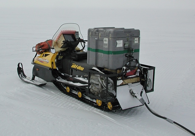
This was mostly an active source experiment with the vast majority of work going into setting off explosions using 1/2 to 1 kilogram of explosives, down holes 20 to 60 meters deep, and a few meters to a couple of kilometers from the sensors. The shot holes were in straight lines that in some cases ran along with the flow of the streams and in other cases in directions that ran across the streams. The sensor cables were stretched out for 1.2 kilometers alongside the shot holes. The shot holes were separated by 300 meters from each other. The idea was that the shock waves from the explosions would go down from the explosion site through the ice layer (up to a couple of kilometers thick!) then into the rock below (up to a couple of more kilometers into the rock) and reflect back up to the sensors -- a reflection survey. A few large explosions were also used up to about 40 kilometers away from the sensors. This was a refraction survey where the shockwaves from the explosions passed through the layers of ice and rock 'sideways', if you will, before reaching sensors, different from the ones attached to the long cables, that measured vibrations in the vertical, 'north-south' and 'east-west' directions. Refraction surveys provide a more three-dimensional picture of what is going on in the ice and rock layers.
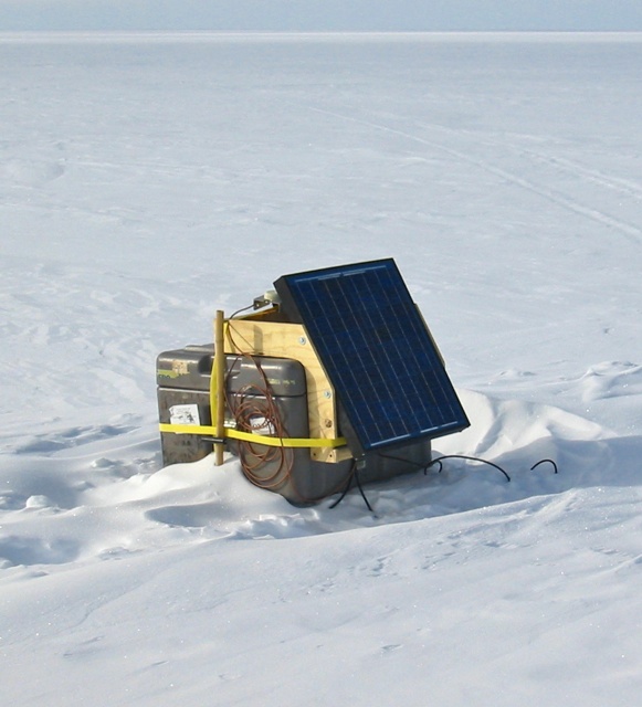
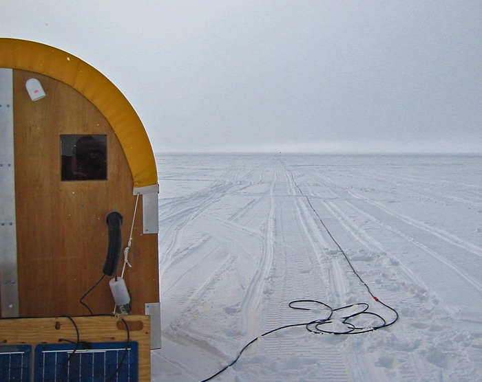
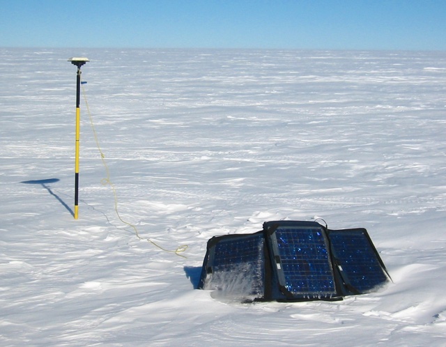
Reftek recorders were set out here and there and were left anywhere from days to weeks to record icequakes. From time to time (a lot of times because of people doing things like moving around or setting off explosions) layers in the upper regions of the ice collapse and cause icequakes, or more correctly, firnquakes. The layer of ice below the top layer of snow is called the firn ice layer. Sensors and recorders like the one above were set out with solar panels for power at Onset-D and in a couple of the other areas where we were working to record these events. The ice in the layer has room to collapse because of the trapped air bubbles. The surface snow is compacted until it becomes ice with bubbles, then the compaction continues until it becomes nothing but ice below the firn ice layer.
The University Of Texas at Austin sent along a portable RADAR system that was pulled behind a Ski-Doo to map the ice around the areas where the reflection and refraction studies were taking place. The RADAR showed different density layers of ice, where sections of the ice had collapsed and caused shifts in the layers, and where there were buried crevasses. Most of the work in this area of Antarctica during the previous 2001-2002 season involved the use of RADAR to see what was going on.
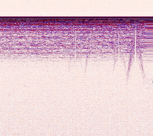
When fed into a processing program the data from the radar system produced images like the one above. The surface is at the top with increasing depth as you go down. The gaps that look like cracks are just that -- crevasses -- that did not extend all of the way up to the surface.
As if all of that wasn't enough, we put out GPS equipment to measure and record the speed of the movement of the ice streams, and anything that was on them, including us, while we were camped in the different areas.
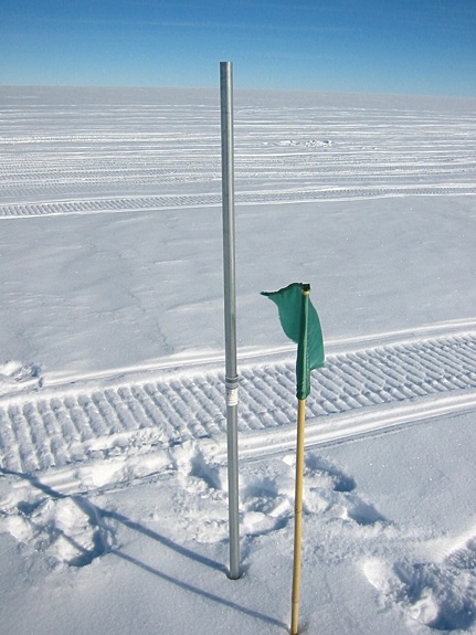
We also measured the GPS positions of poles left to drift with the ice streams by projects in earlier years.
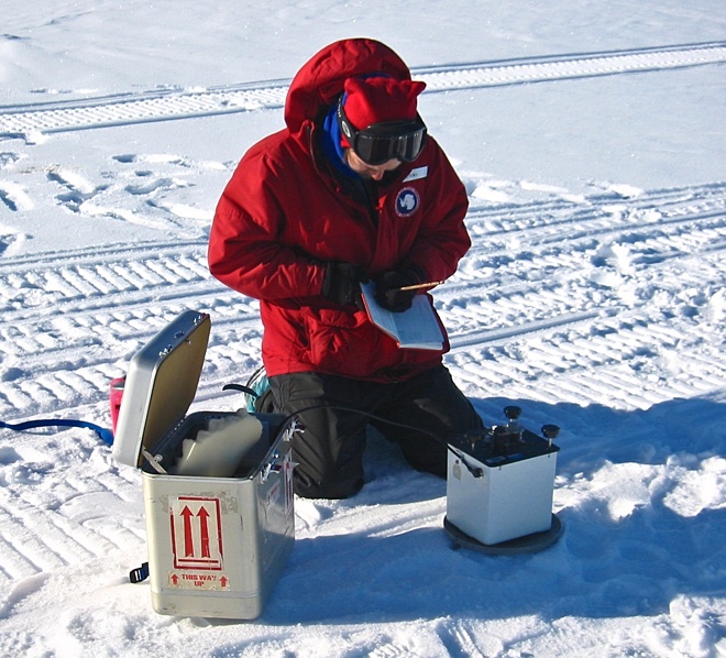
AND we took some gravity measurements at Onset-D and many other points along
our shot lines with a portable gravimeter.
Various biological experiments were also carried out under the dubious headings
of "breakfast", "lunch", and "dinner".

2018-03-05