


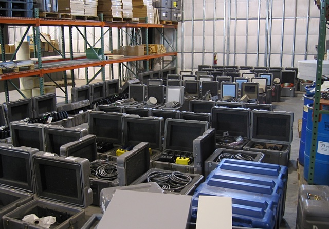
Approximately US$1,000,000 worth of equipment was shipped over to Italy for
this project from PASSCAL's little warehouse in Socorro, New Mexico. I packed
all of it. I managed not to forget anything...this time.
 Above is a picture of part of the shipment's shipping boxes before they were
strapped to the shipping pallets.
Above is a picture of part of the shipment's shipping boxes before they were
strapped to the shipping pallets.
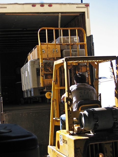
The shipment ended up having a total weight of over 2,500 kilograms and it required eight pallets. Unfortunately the wooden box in the picture above was the one, but only, victim of the shipment. It was never seen again.
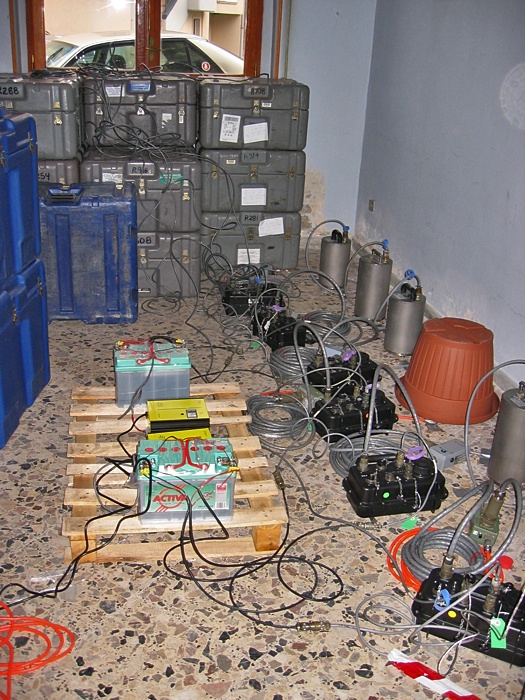
The equipment beat me to Grottaminarda. When I arrived it was hauled over to our field center at the castle and sorted. We usually test all of the sensors and recording equipment that is shipped as soon as everything arrives to determine how well all of it survived the trip. We call this a "huddle test". One round of huddle testing is shown in the picture above. I did not have enough room to set up all 40 stations worth of equipment all at once, so I had to test the equipment in groups of 6-8 instruments at a time. Everything is set up and programmed just as it will be when installed in the field. The equipment is then allowed to run for at least 24 hours. When the test is finished the data is downloaded from the data recorders and examined to determine how well the equipment performed. Equipment that appears to need adjustments or repairs is fixed, if possible, and then retested. Above are two batteries and two yellow battery chargers on the wooden pallet. All of the field equipment runs on 12 Volts DC electricity. The black boxes on the floor are the Reftek RT-130 digitizers/recorders. They convert the analog signals from the sensors into digital data and record the data at specified sample rates to Compact Flash "disks". The sensors are the cylinders next to the wall. The brown object is a plastic flowerpot that we found at a local hardware store. There is a sensor hiding underneath it. You will see more of those as the story continues.
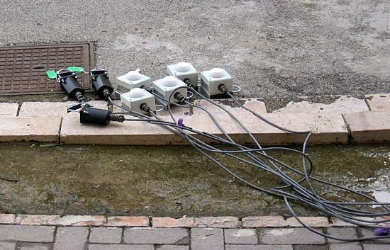
GPS receivers were connected to the recorders to obtain accurate time information. The data from all of the stations, as well as data from stations all over the world in some cases, needs to be synchronized when using the data to do things like locate earthquakes and 'image' what is below the surface of the ground. With the GPS receivers in the picture above (one for each data recorder), and the fairly stable internal clock inside the recorders, which keep time while the GPS receivers are turned off to save power, the time assigned to each sample of data can be accurate to within a few microseconds of the real time.
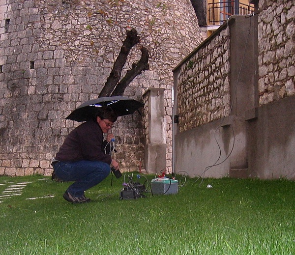
GPS radio signals do not go through buildings, and the street that the antennas in the picture above were laying in was surrounded by two and three-story apartment buildings and castle towers. Some of the GPS receivers just plain refused to lock on to the GPS satellite signals during the huddle testing. Above I am sitting in the rain, still in the shadow of the castle, but in a slightly more open area checking to make sure that the reason why they would not lock was because they were broken and not that they just could not see enough satellites. The equipment is weatherproof, but I am not. It turned out that a couple of them really did need minor repairs to get them working, but for the most part all of the equipment seemed to survive the trip in good shape.
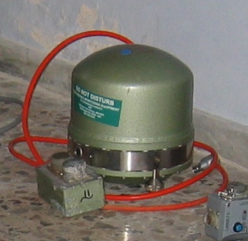
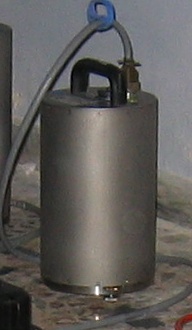
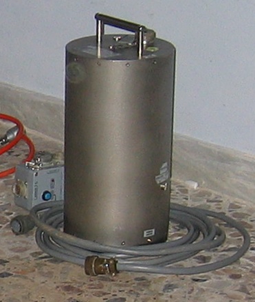
This project had just about one of everything as far as sensors were concerned.
2003 was a pretty busy year at PASSCAL, and we had to send combinations of
whatever we had left in equipment for some experiments. All three sensors
for this experiment were of the same general category known as broadband or
long-period sensors. These sensors were designed to be very sensitive, and
to be sensitive to waves (like waves in the ocean) that were from 30 to 120
seconds in length (i.e. the crest of one wave to the crest of the next wave
being 30 to 120 seconds apart). The vibrations that earthquakes generate,
and that can travel all of the way around the earth, have periods in this
range. The green sensor above is a Streckeisen STS-2, the next one is a Guralp
3T, and the last one is a Guralp ESP.
The basic routine for installing the stations was to first establish some
connection with someone in the location where we wanted to place a station.
That was usually done through someone knowing someone in a town near where
we wanted to go (an aide to the local mayor, or the city engineer, for example),
or by contacting someone's aunt living in a place where a sensor had been
before as part of another experiment. Sometimes it was accomplished by just
knocking on doors, making inquiries at a local bar, or making phone calls
to tourist attractions in the target area. You name it. We tried it. And
most of the time it worked. Once a contact was made we would either go to
the location and begin scouting for an actual building, inspect a place that
had been suggested to us, or just start installing the station because everything
was perfect when we arrived. The last situation rarely happened.
For some experiments elaborate vaults are constructed in very carefully selected
places to house the stations and sensors. Locations for this experiment were
simpler by necessity because of the time constraints. This was not going to
be a very lengthy project. However, there were a few rules we tried to follow
as best we could when looking for station locations. The station could not
be too near to roads, factories, machinery, underground pipelines, railroads,
tunnels, large trees, or collections of farm animals. They can all cause
low-frequency noise when the wind blows through them, when large objects or
liquids flow through them, or they can eat the wiring, or dig up the sensor.
If a building was found it was best if it was at the end of a street, instead
of having streets (and traffic) around it. The sensor could not be on, for
example, the second floor of a building, because of vibrations in the floor.
The floor used had to be setting on the ground, and better yet rock to provide
a solid connection to the earth. If possible the sensor was not placed next
to a wall exposed to the sun. The heat could cause the foundation to expand
and contract which the sensor would detect and show as noise in the data.
Now if the perfect place was found there still had to be a nearby power outlet,
or a place to mount a solar panel along with a hole in the wall through which
to run the power and GPS cables. If a solar panel was used it was nice if
it could be placed somewhere where it would not "stick out" and
draw attention to the station, of course, it still had to have access to the
sun. Those were a few of the rules, anyway. Despite these, or in spite of
these, we still managed to find some good places.
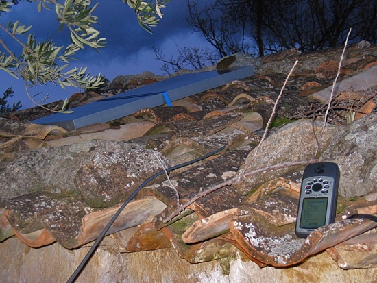
The handheld GPS receiver that I brought with me for this trip was my trusty Garmin GPSmap76S. With all of the places I went, and roads I went on, it was a basic necessity to keep me from getting lost. I have such a bad sense of direction that I usually carry it with me just to take out the garbage when I am at home. This is the same GPS receiver that I had with me in Antarctica and on other trips. For this trip I loaded it up with road maps from Garmin's MapSource Roads & Recreation Europe map package. The accuracy was not 100%, but it wasn't too bad. It had just about every road that you would want to travel down without a four-wheel drive vehicle. It was not quite turned on all of the time, but the trip odometer that the GPS used to show the total distance that it moved during the six weeks that I was in Italy registered over 15,000 kilometers! That doesn't include the flight over and back -- that is JUST the driving distance in Italy! We definitely covered some ground, and some of it several times. Above my map76S is taking a break from traveling and setting on the roof of a building talking with a solar panel while averaging the position for a few minutes of the station in the town of Altomonte while we finished the installation of the station.
All of the pictures that I took on this trip, about 6500 of them, were taken with my Canon PowerShot S400. With four megapixels it did a better job than my old PowerShot S200 when it came to cropping a better picture out of a larger picture, but it seemed a bit 'slow', photographically speaking, and I ended up with a lot more blurry pictures than I feel like I would have had with the S200. At some point it also developed a dark, fuzzy spot that showed up at the edge of every picture. Of course you will never see that spot in any of these pictures. Cropping is our friend.
2018-03-05