


Part of the deployment line crossed right through the middle of one of the neater places on earth. During the last Ice Age, about 15,000 years ago, Lake Bonneville, the remains of an ancient inland sea, was the size of Lake Michigan. The lake covered one-third of present day Utah and parts of the neighboring states. The Bonneville Salt Flats and the Great Salt Lake are remnants of the ancient Lake Bonneville. Halfway up the sides of many mountains surrounding the salt flats you can still see traces of the shorelines. Wind and water combine to create the flat surface of salt. Each winter, a shallow layer of standing water floods the surface of the salt flats. During spring and summer, the water slowly evaporates while winds smooth the surface into a vast, nearly perfectly flat plain.
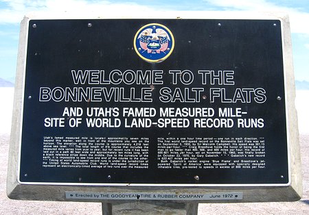
Although he never visited the salt flats, the area is named for Captain B.L.E. Bonneville, whose expeditions in the 1830's proved the area was part of an ancient basin.
Humans have lived in the Great Basin area of Nevada, Idaho, Montana and Utah
for thousands of years. Remains found at Danger Cave just north of Wendover
show that the area was occupied as early as 10,300 years ago. In 1824, a
mountain man by the name of Jim Bridger and others, explored the Great Salt
Lake desert region. The first recorded crossing of the desert was made in
1845 by Captain John C. Fremont's survey party, with scouts Kit Carson and
Joe Walker. Early the next year, 23 year old Lansford Hastings retraced Fremont's
trail across the salt plain. Joe Walker's writings warned emigrants not to
attempt the untried route; however, Hastings convinced several emigrant parties
to follow him. Despite Walker's warnings, the Donner-Reed party, seeking a
shortcut to California in 1846, attempted the "Hastings Cutoff".
They failed to take enough water and lost a critical number of oxen. Four
of their wagons were abandoned just 10 miles northeast of the salt flats.
Time was lost, and the delay resulted in their late arrival to the Sierra
Nevada Mountains and their tragic, but tasty, winter.
The first permanent crossing of the Bonneville Salt Flats was completed in
1910 when the Southern Pacific Railroad was built linking Salt Lake City and
San Francisco.
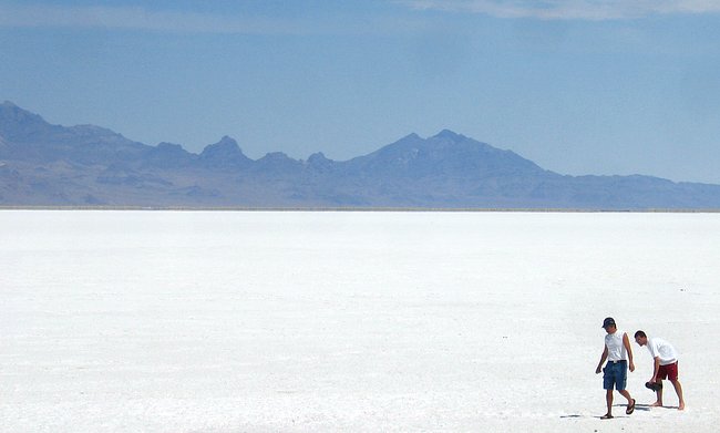
Above is looking out over just the very extreme western edge of the salt flats in the direction of the Silver Island Mountains.
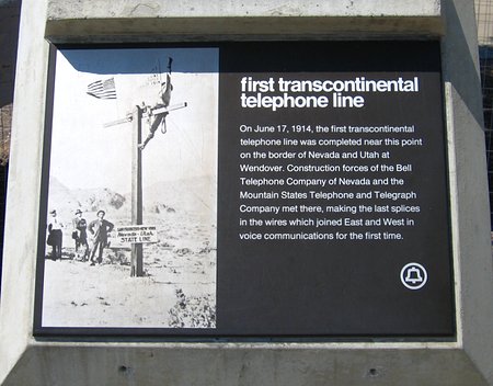
On June 17, 1914, near Wendover and the Nevada-Utah border, the last of 130,000 poles of the transcontinental telephone line was set. The first test of the New York to San Francisco circuit of this line took place a month later, but commercial service did not start until January of the following year. On January 25, 1915 at 4 PM EST commercial transcontinental phone service was officially inaugurated with ceremonies at AT&T headquarters in New York City and at the Panama-Pacific Exposition in San Francisco. In New York City, sixty-eight year-old Alexander Graham Bell connected a replica of his original "gallows-type"telephone to the line, and repeated the first words ever spoken and heard by telephone."Mr. Watson, come here. I want you", he told his former assistant in San Francisco. Thomas Watson replied that he would love to, but that now it would take him a week to get there.
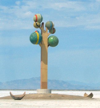
Sprouting out of the salt flats about 25 miles east of Wendover was an eighty-five foot concrete and steel sculpture known as "Metaphor --Tree of Utah" by Karl Momen. It's art. I guess. I would have used the money to feed some people, instead of myself, but then I'm not an artist.
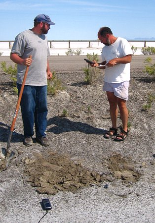
Since all of Willie's and my work was pretty much finished for this part of the experiment we went out with Shaun and Chris to help them deploy the last of the instruments on the salt flats. OK. We really went along just to monitor them and make sure they were doing the right thing. OK. Since these two had probably deployed over a thousand Texans between them over the years we actually ended up mostly just running around licking the salt and taking pictures while they did the work.
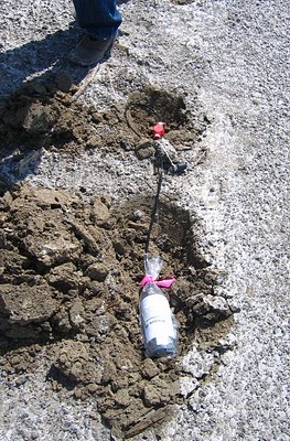
The instruments here and all along the line were buried in shallow holes. This was done to partially hide the instruments and to partially shield them from the desert sun. The internal clock of the instruments are pretty stable, which is important when it comes time -- no pun intended -- to recombine the data from all of the instruments, but the more constant the temperature can be kept the better. As each instrument was put in place information such as its serial number, the date/time, and its position was recorded along with any tidbits of information that would help in locating it when the time came to find it again. The instruments were deployed roughly about 1/2 of a mile from each other along the line.
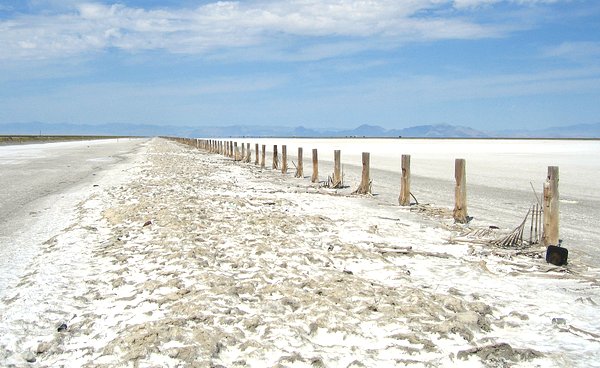
I'm not sure who would but up something like a barbed wire fence out here, if that is what these fence posts were for, but if they did with all of the salt in the area I'd guess it lasted maybe ten minutes.
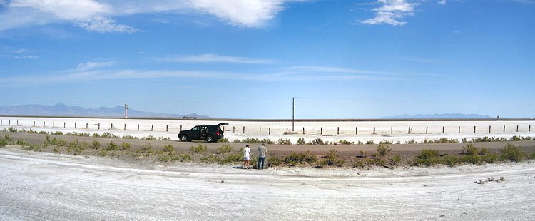
Ahh...the great outdoors.
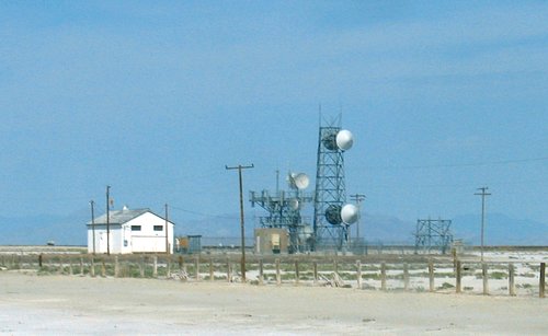
These were the shortest microwave towers I'd ever seen. It made sense, though. There wasn't anything to get in the way of the signals. This was the microwave station at Barro that was part-way across the flats.
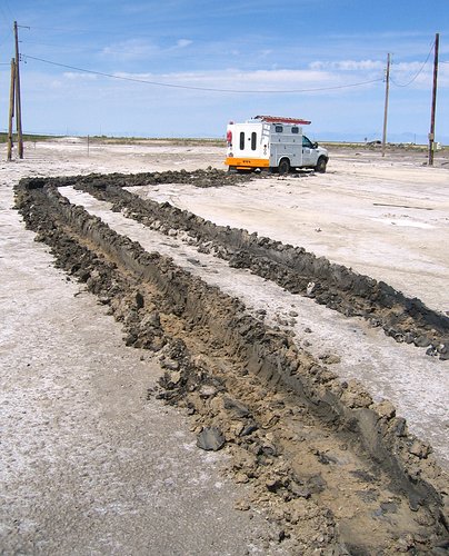
The surface of the salt flats is pretty hard until you try to drive a phone company truck on it. We stopped to see if we could help, but the operator already had help on the way. He had a winch on the front of the truck and managed to pull himself out of trouble a little bit, that is until the power pole he was hitched up to started to snap off at ground level.

This is old highway US-93. It runs parallel to Interstate 80 and was what we deployed the instruments along. It appeared to just exist and no longer be maintained. I remember this stretch of road from the 1960's when my parents and I would travel from South Dakota to California on vacations.
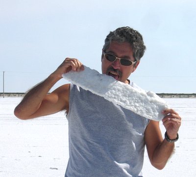
Yup. It tasted salty, but it wasn't just like the salt you'd find on your dinning room table. The salt flats aren't just "salt", but "salts" of potassium, magnesium, lithium, plus regular old sodium chloride.
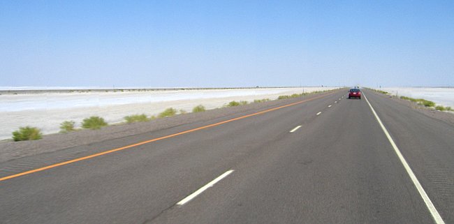
Interstate 80 was in a lot better shape than US-93.
2018-01-27