


The National Oceanic and Atmospheric Administration (NOAA) helped us quite a bit on Tutuila. The National Weather Service branch down by the airport in Tafuna gave us a place to keep our leftover spare parts, tools and shipping containers, and the atmospheric monitoring branch let us dig up the lawn at their station and put in a seismic site.
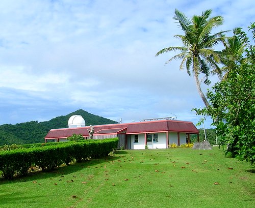
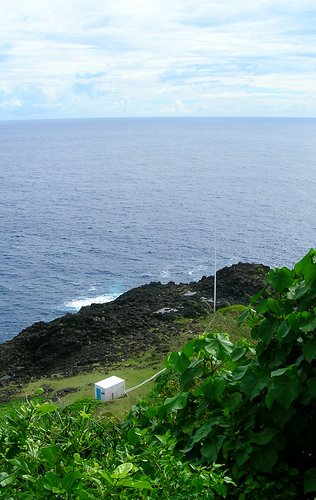
On Lau'agae Ridge on the east end of the island, overlooking the village of Tula, was NOAA's Cape Matatula Observatory. You can just barely see the white dome in the picture below.
NOAA is part of the U.S. Department of Commerce. This observatory was a baseline observatory of the National Oceanic and Atmospheric Administration's Climate Monitoring and Diagnostics Laboratory. That wasn't quite impressive-sounding enough so the observatory, instead, became part of the National Oceanic and Atmospheric Administration's Earth System Research Laboratory, Global Monitoring Division in October of 2005.
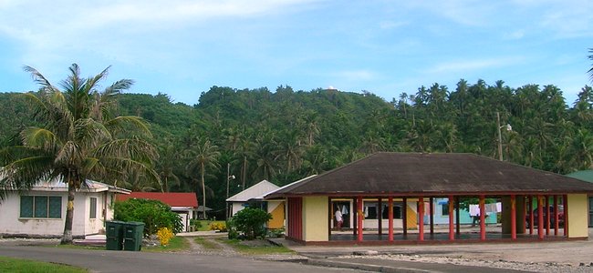
The main building housed a lab, offices, and an electronics equipment room. Olomoana Peak is in the background in the picture below.
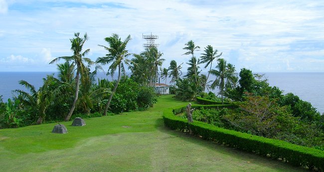
There was more equipment towards the end of the point. That equipment included both weather and atmospheric monitoring equipment as well as a cell phone tower. The two grey cement piers on the left in the picture below were historical landmarks. During WWII they held the panels of a radar installation. There was a whole radar panel a couple of mountain ridges west. We couldn't figure out what that one was until Mark told us about this one.
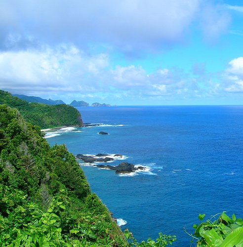
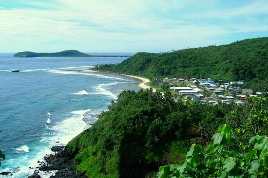
Below is a picture looking west along the north shore of Tutuila Island. In the foreground is Nu'utele Rocks with Nu'uiti Rockby itself just beyond. Papaloa Point is next with Polauta Ridge and Pola Island about 6 miles away. The distance to Pola Island was about 1/3 of the way to the west end of the island. Yes, the water really was that color.
Below the picture is roughly looking southwest along the beginning of the south coast of the island. Fagasa Point is in the foreground, then the village of Tula, and then Maliuga Point. Aunu'u Island is in the background. Aunu'u was a nice place to explore, which was probably why I didn't make it out there. There were lakes and hills and coves and quicksand to checkout.
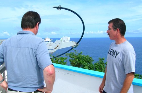
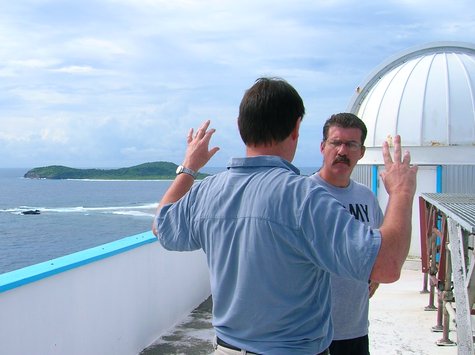
Mark Cunningham, the man in charge of the facility, gave us the US$1.00 tour of the facility. Mark's biggest problem with all of the mechanical and electronic equipment at the station was corrosion. A fine salt spray -- almost like a fog -- is kicked up from the ocean when the waves are large and it tended to get into everything and start chewing away. Keeping up with it was a full time job in itself in addition to all of the atmospheric measurements and air sampling that had to be done on a day-to-day basis.
Apparently, with all of that work, the US$2.00 we gave him for the tour wasn't enough. We gave him a couple more to let John go.
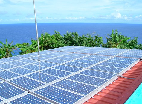
30% of the station's power came from an array of solar panels on the roof of the carport. In older pictures of the station it could be seen that the panels were mounted on frames that tilted to follow the sun...if someone went out and tilted them. When that system corroded to the point of needing to be replaced it was decided to simplify everything and just mount them on the roof. At a latitude of 14 degrees south it was close enough. The station also had a backup generator down the hill if the island's commercial power went out. A lot of the equipment had to keep things like cryogenic refrigeration systems and vacuum pumps running or else it was a long and complicated recovery process.
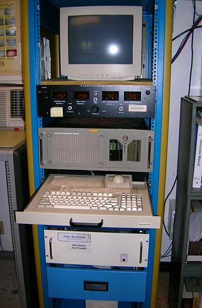
Data from a lot of the equipment at the station could be monitored and recorded at a central location in the main building. The communication network for all of this was a simple RS-485 serial network. That was the same kind of equipment network that was used on the Very Long Baseline Array radio telescope antennas that I worked with in another life.
Below is a picture of a famous graph (if you're a geek, or an environmentalist. I admit it. I'd seen it before.). It shows the atmosphere's carbon dioxide level as measured at the four NOAA baseline observatories spread out from the North Pole to the South Pole. It shows how the CO2 level has steadily increased over the past years.
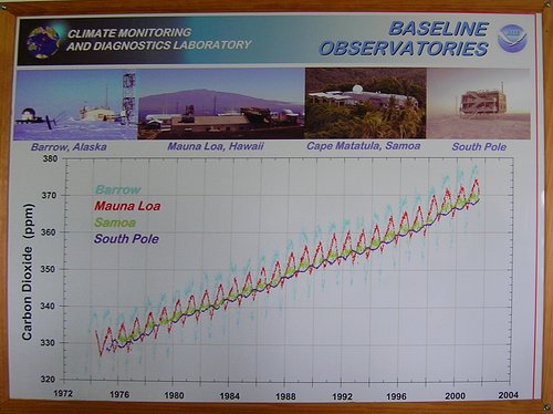
A 187-step staircase led down from where the picture below was taken -- out next to the mobile phone tower -- to the rocky outcrop of Cape Matatula. The building, the white pipe, and the 60 foot high tower were parts of the atmospheric sampling system. The air samples taken for the graph above were collected from here.
The various atmospheric samples taken at the station once a week were kept in large glass spheres which were mailed off to various labs for analysis back on the mainland.
2014-07-23