


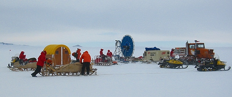
Now be honest. The picture above looks like some kind of bizarre, traveling circus complete with a Ferris wheel, or better yet a band of gypsies, doesn't it? If you thought so you are pretty close.

One part of the seismic recording equipment for this experiment was 1.2 kilometers of cable. For this shakedown exercise we only used two of the eight 150 meter long cables that we had, or 300 meters. The two cables were attached to each other and the sensors were attached to the cables every 10 meters.
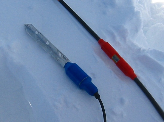
The geophone sensors we used were pretty standard 40 Hz geophones with long spikes for use in snow. The cables and these geophones were specially ordered with clip points on the cables that made them easy to attach and remove from the main data cable. Since there's little or no moisture floating around in Antarctica (it's all frozen) electrical connectors with exposed bits like these ones are able to be used.
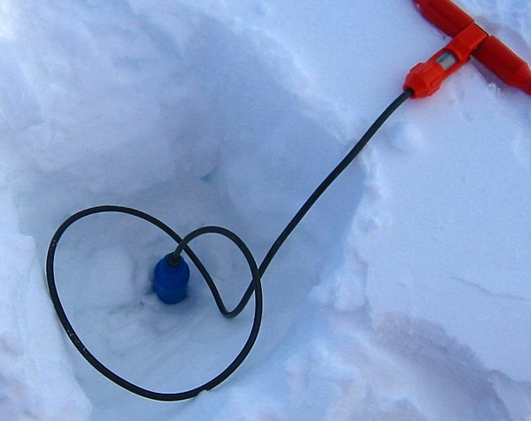
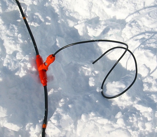
The geophones were buried in shallow holes to minimize noise and vibrations from the wind.
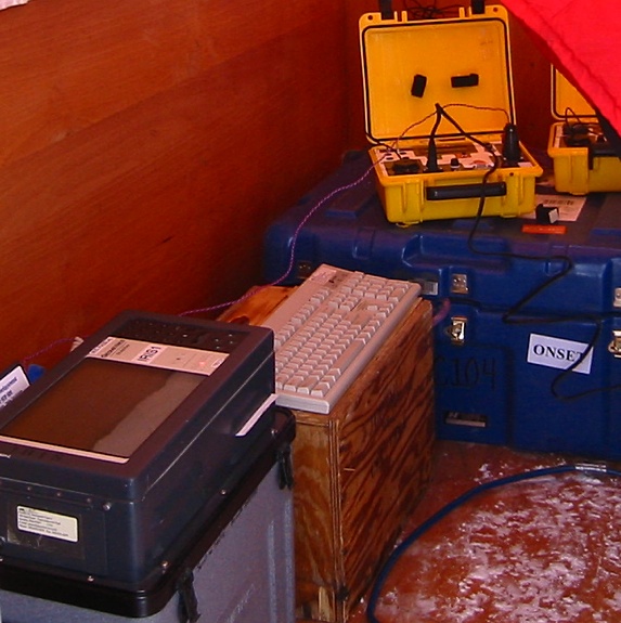
The gray box in the foreground of the picture above is the recording unit that we used. It was a Geometrics StrataVisor. It could record the signals from up to 60 geophone sensors at the same time. We were constantly worried throughout the expedition that the cold, and all of the bouncing across the snow would take its toll on the Geometrics units. They have a lot of printed circuit boards and connectors in them. We needed two of them, but had three of them in Antarctica. Nothing bad happened. They all worked just fine. The yellow box in the picture is the shot box. It was used to send the electrical signal to set off the explosives, and to trigger the Geometrics to begin recording when the explosives were set off. The shot box had a GPS receiver in it. This allowed it to send the signal to set off the explosives and start the recorder exactly (and I mean EXACTLY) on the minute. By using this method you could have one shot box connected to the detonator, and another shot box connected to the recorder -- as far apart as you needed -- and both the explosion and the start of recording would occur at exactly the same time. The shot boxes were built by Bruce Long for the folks at Penn State.
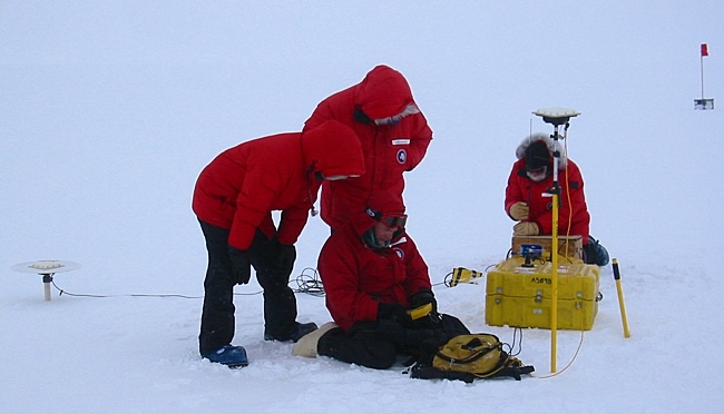
If you don't know where you are then you might as well not be anywhere near an experiment like this. Precise measurement of the position (on the earth) of the lines of sensors, and the positions of the shot holes was needed to make sense out of the recorded seismic data generated by the explosions. The University NAVSTAR Consortium (UNAVCO), an organization that supplies GPS equipment and people to operate it for scientists to use in experiments, much like PASSCAL supplies seismic measuring equipment and people to operate it, helped with this project. Their equipment had two parts. A GPS base station, whose position was well known since it was not moving, transmitted error correction information to a roving GPS unit strapped to someone's back. This allowed the position of the roving GPS, as it moved from one place to the next, to be precisely measured down to a couple of centimeters accuracy. Above is Shad O'Neel, who worked for UNAVCO, prostrating himself before the GPS god, Trimble, to get the system up and running. This seemed to be a normal operating procedure when using Trimble brand GPS equipment.
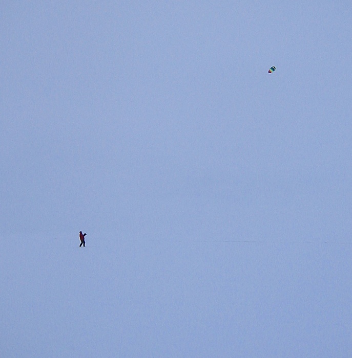
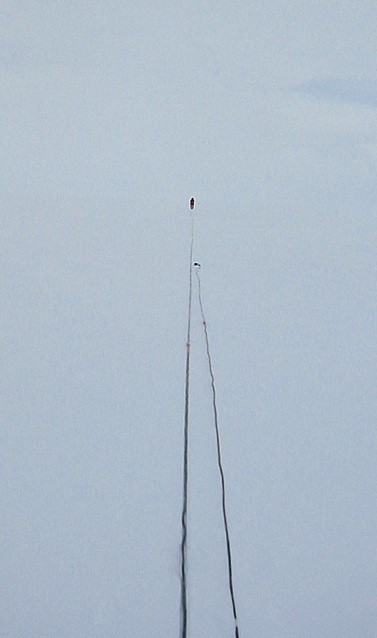
It wasn't all work and no play. When we were finished for the day Shad tried a little kite flying. There was plenty of wind.
2018-03-05