


The last line of instruments that I helped to deploy were to remain in the area for a few months through the winter mostly to catch local earthquakes. The 'passive deployment line' ("passive" since it was not going to be recording any noises made by us) was roughly east-west and ran from north of Summit Lake, which was about 80 miles northwest of Winnemucca to about 20 miles to the west of the lake. The eastern half of this line was sensible. The western half was a little crazy toward the end.
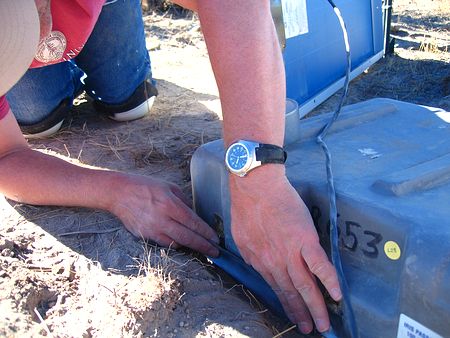
Four of us headed out from Soldier Meadows Ranch for a full day of good deploying. The equipment had other plans. We were going to use 30 of the Ref Tek model 130 recorders that we had used earlier with the L-28 sensors and with the long cables. They weren't the problem. We were using, for the first time, some Kinemetrics EpiSensors which were totally electronic, accelerometer-based sensors. In my experience they are perfectly unsuited for harsh field work. I went through and tested all 20 or so of them for this experiment back at the shop at the Soldier Meadows Ranch and the overnight signals from all of them looked bad. Having never worked with them before I at least expected to see something close to the signal produced by a normal seismometer, which is what you should see, but with the overnight temperature fluctuations in the garage where I was working, and with an electric diesel generator for the ranch nearby I just figured they were really sensitive and what I got was as good as it was going to get.
These particular units were designed as the kinds of sensors you placed in the basements of buildings in San Francisco, or ON the San Andreas fault, but not anywhere near the state where Area 51 is located. They even had a clip mounted to the bottom of them so they could be semi-permanently attached to a bolt sticking out of something heavy like the foundation of a building. They were just the wrong sensor for PASSCAL-type projects in the real world. I don't think we've used them since (and I'm writing this in July 2006), but we have, for some unknown reason, bought 20 more of them at several-thousand dollars apiece.
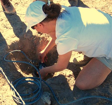
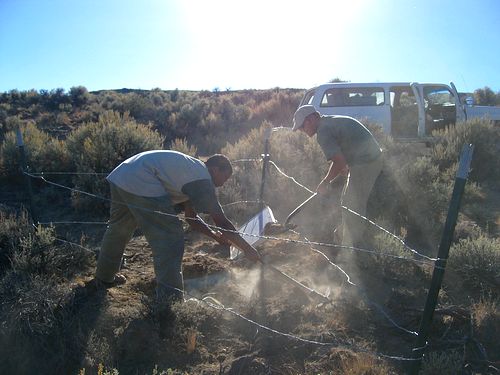
Below is Marleen Nyst of Stanford trying to get our first sensor of the day leveled. It wasn't overly difficult to get the sensors level, but the combination of the sensors being so light, the cable to them being so thick, and the dirt being not much more than a dry powder made them (probably) impossible to keep level by the time the station was installed.
We did our best to install a few of them, but it just didn't work out. The signals from our "stomp test" during installation (you stomp on the ground while watching the output signal from the recorder) were just plain nonsensical.
We left the first station the way it was to collect a little data overnight, but then finished the eastern half of the line that day using the L-22 sensors that were going to have to be used anyway (there were never enough of the EpiSensors for the whole line). A satellite phone call was made back to PASSCAL who then FedEx'ed out enough L-22 sensors to finish the line. Since there wasn't anywhere closer to send them to they went to Winnemucca. Great.
Derek laid out and flagged the whole deployment line in the weeks before the experiment started. As you were driving along through the wilderness right on the verge of thinking you were lost or on the wrong road one of Derek's flags would pop up out of nowhere tied to a bush or a weed and you'd know you were OK.
We installed the stations right next to the road. It didn't seem to be a high traffic area. I don't think any of the stations were disturbed by anyone or anything for the entire time they were there. Now THAT's the kind of place to do an experiment.
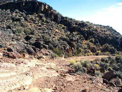
You mean THIS road!? The last few stations of the western half were reached by slowly going down the face of a small mountainside/cliff on a road that for the most part looked like the picture below.
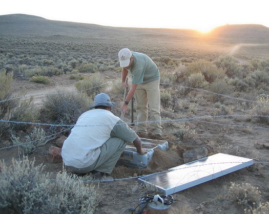
Two batteries, the green power box that controlled charging of the batteries from the solar panel, and the recorder all fit into the the shipping boxes that the equipment came in. It was pretty convenient. It seemed like a good idea at the time until the snows came...but mostly when the snows left.
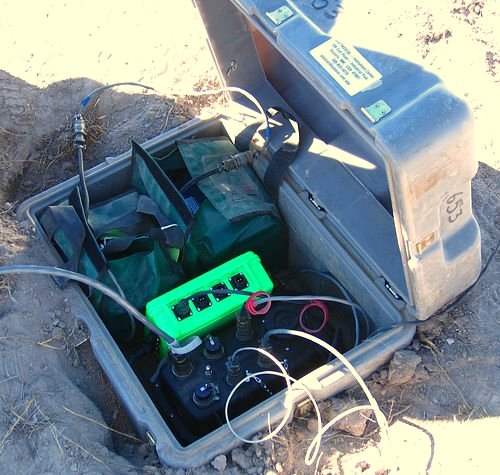
I guess -- my fault -- we buried the boxes a little too deep. I just wasn't thinking. When we put them in we sealed them up with good ol' duct tape to keep the dirt out when we buried them. I mentioned that some heavy plastic bags should be brought out, and the contents of boxes should be put into them on the first service run (a couple of weeks after we installed the stations) if water was going to be a problem, but I don't know if that was done or if it would have even helped. Anyway, the area, contrary to the way it felt on this day, got quite a bit of snow during the winter and several of the stations flooded.
We buried the the boxes under about six inches of dirt to help insulate them from the sun and the coming cold.
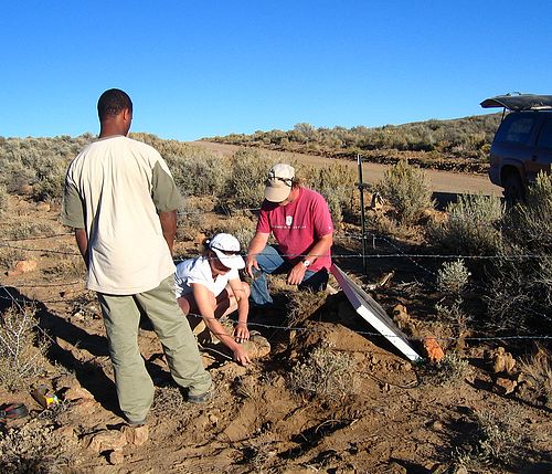
Brian Romans of Stanford, standing, was with Ewnet and me for this last bit of deploying. This was the last station we got installed. We managed to get 18 stations put in -- all the L-22 sensors that we had -- in the two days we were in the area. We finished up by distributing some of the equipment, like solar panels and batteries, to the remaining sites.
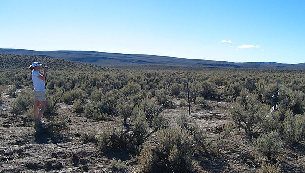
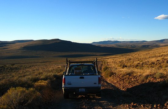
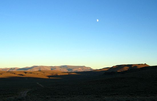
Below is looking southeast along the road north of Summit Lake just as it turns southeast. This is about an hour from the ranch.
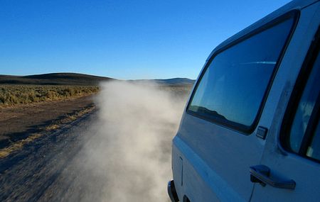
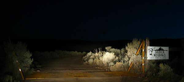
The distances were just not as great as the amount of time that it took to get around would suggest. Back to Soldier Meadows Ranch...in the dark...again. I think it was still about another 20 minutes from this sign to the ranch house.
2018-02-08