


Engineers Jeff Alwin and David Musick at the The Kirwin Television Center (KVZK-TV) in Utulei helped us out a lot. They were kind enough to collect our equipment as it arrived on the island, which was before we did, and they provided a place for us to keep our equipment while we were working on the island and getting our bearings.
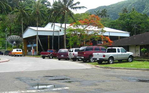
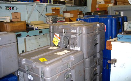
We shipped 18 boxes of stuff to the islands. All of them filled up a portion of the TV station's electronics lab. We usually try to ship boxes like this on pallets to minimize the chances of individual boxes being lost or excessively thrown around damaging the equipment inside. This time we knew there was no way to get this much equipment to American Samoa on a pallet, by air, so we bit the bullet and shipped the individual boxes by FedEx Freight. Everything was fine until the online tracking system showed boxes heading for, and getting stuck in, New Zealand and Australia. At this point panic set in. What FedEx forgot to mention was that they turn the equipment over to a 3rd party in New Zealand (something we were assured would not happen -- tsk tsk tsk) for final transport to American Samoa. So while the boxes appeared to be scattered all over the South Pacific they actually, slowly made their way to Pago Pago via New Zealand, independent Samoa and finally American Samoa. We never did understand why a couple packages went to Australia and back to New Zealand.
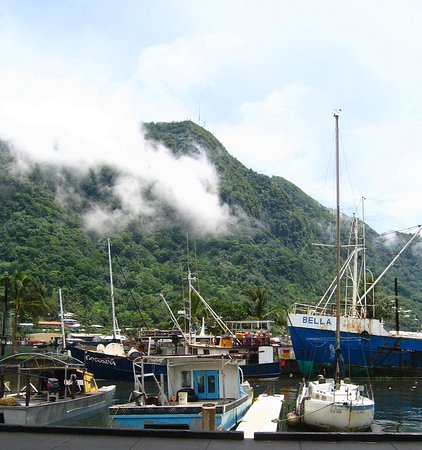
So how did we get mixed up with the local TV station -- or vice versa? On a previous trip to the islands Matt made contact with Jeff as part of his search for places to put our seismic stations. One possible site he found was not near the boats in the picture below, exactly, but near the antennas in the background above the boats on top of 1610 foot Mt. 'Alava where the TV station's transmission towers were located.
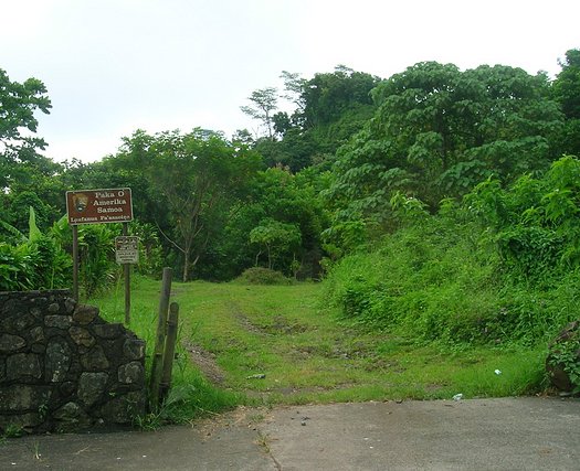
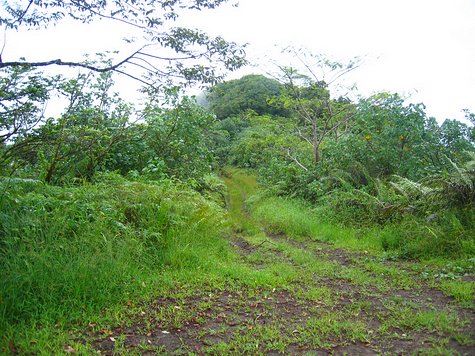
On the Saturday after we arrived Jeff and Dave took us for a ride. Below was the start of the "road" that ran along the Maugaloa Ridge and that took you to the top of the mountain. It was a turnoff up the hill from the northern end of the town of Pago Pago at Fagasa Pass. This was the good end of the road.
Below is looking back down the road from the top of Mt. 'Alava. The route is about 3 miles and 25 minutes long, so this picture doesn't show much of it, and you'll see why I didn't take more of them below.
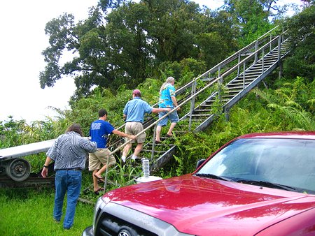
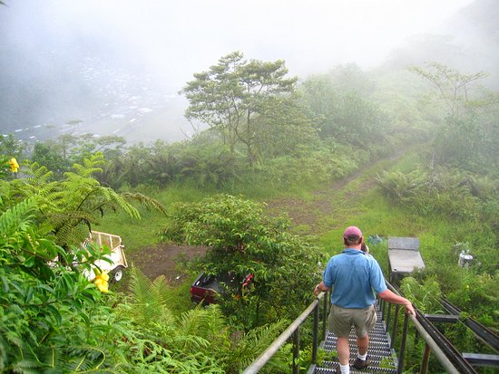
At the end of the road was a parking area and a staircase to the peak.
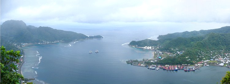
Below was the view of Pago Pago Harbor looking out to sea from the top. At the mouth of the harbor was Breakers Point and Fa'ata'aga Point on the left, and on the right Tututulu Point (the further one) and Goat Island Point.
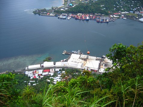
From the lookout point you looked down on the two tuna canneries. Goat Island and the container dock were on the other side of the harbor. A container ship from Hawai'i came and went every couple of weeks. Coming out of the bushes in the foreground of the picture below you can just barely see a cable making its way across to the other side of the harbor. In the 1960's this was a cable car line -- the longest in the Pacific -- that was originally installed for the maintenance of the television transmission equipment, but then it became a tourist attraction. Once the "road" that we came up on was built the cable car system was eventually shut down. There is continuing talk of starting it back up. I don't know about the far end of the line, but the facility at this end would have required a total rebuild. The cable in the picture is not the actual cable, but one that would be used to string the actual cable across if the line were ever rebuilt. Hey! What about a zip line??
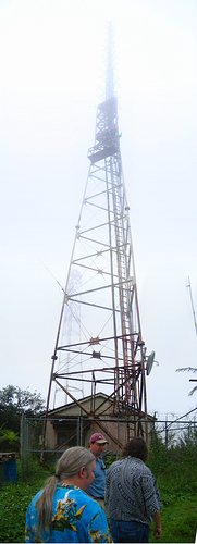
The weather wasn't great the day we were there. Below was the main transmission tower and the equipment building.
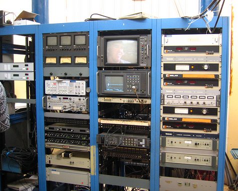
Inside the building was your typical TV transmission stuff. The TV station was originally built in 1964 by then governor Hyrum Rex Lee. It's primary use was revolutionary for its time: Educational television.
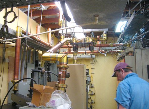
Below are the waveguides that carried the 50,000 watts of TV signals up to the antenna.
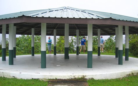
Beyond the antennas at the top of the mountain was a fale built by the U.S. National Park Service. The top of the Maugaloa Ridge -- where we were walking, touring, and driving -- was the border of the Tutuila portion of the National Park of American Samoa which covered a good section of the northern shore of Tutuila..
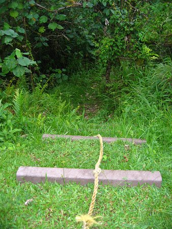
Beyond the fale was a rope to help you down a steep portion of of an overgrown hiking path which you could take all of the way down to the bottom of the mountain, via hiking or falling, I suppose.
After looking around for about an hour we, unfortunately, came to the conclusion that this place was unsuitable as a seismic site. The noise from the canneries 1600 feet below could definitely be heard, and we were pretty sure we could even feel a vibration from either the canneries, or the island's nearby diesel power generators. In addition to that the ridge top was pretty pointy. This can cause a form of deformation of the seismic signals. On top of that, rock, while appearing to be hard enough when thrown at you, is actually pretty flexible, and the tall transmission towers flexing in the wind and anchored to the mountain would have caused the area on top of the mountain to move enough to be picked up by the sensors. Did I mention that these sensors were pretty sensitive? It's too bad. It was the only place during the whole trip that I got to go where it was cool.
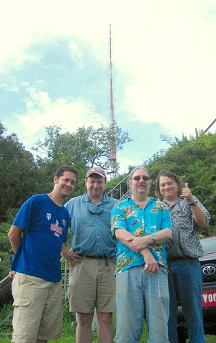
Matt, John, David and Jeff.
The ride back down off of the mountain was just as exciting as the ride up. This "road" was advertised as a hiking trail in the tour guides. I suspect it made a better hiking trail than it did a road.
John got to ride in the back of the truck on the way down. I never get to do anything fun. Doesn't he look like he's having fun?? Actually, I think he was hanging on for his life.
2014-08-03