


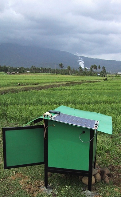
Twelve seismic stations were set out at Tiwi. The folks at Tiwi did a nice job of constructing 'dog houses' for the instruments and their batteries. Most of them were installed before the equipment arrived. At some of the sites there were concerns about theft of the equipment -- mostly from armed insurgents -- so the houses were built, and a local caretaker was hired at each site to keep an eye on things. I didn't know armed insurgents were so into seismology.
The station houses where better constructed that most of the people houses in the area. Angle iron set in cement, thick plywood, a tin roof, and a door with hinges. If they were bigger you could live in them.
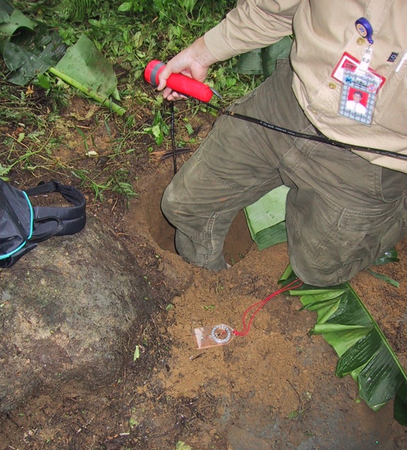
While the DAS, battery, and power regulator lived in the dog house, the sensor lived in the ground. The sensors for this experiment were L-28's. They are simple sensors capable of measuring vibrations in the vertical direction, and two horizontal directions -- three channels. A hole about 30cm deep was dug near each dog house to plant the sensors in.
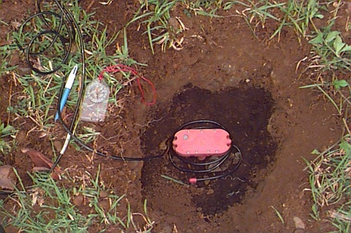
The sensor was aligned with the Earth's magnetic field (a fancy way of saying "pointed north"), and leveled with a built-in bubble level. North is up in the photograph below. The alignment of the sensor allows one of the horizontal channels of data to measure movement of the sensor north and south, and the second horizontal channel to measure movement east and west. Leveling the sensor allows the third channel to measure movement up and down, and also keeps gravity from adversely affecting the two horizontal sensors. If the sensors are tilted too much the moving bits inside will start rubbing on the non-moving bits and weaker signals will not get recorded.
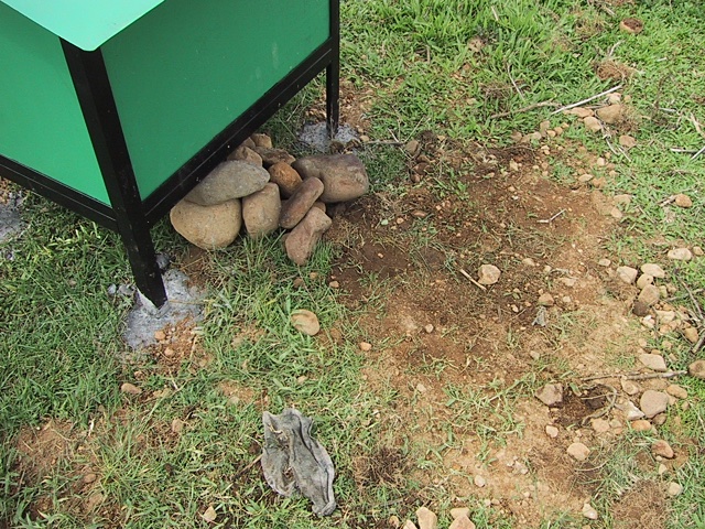
The sensor was connected to the DAS with a cable. The cable ran from the ground up through a hole in the bottom of the doghouse. The cable was covered with a pile of rocks at some sites to prevent the cows and other animals from chewing on it.
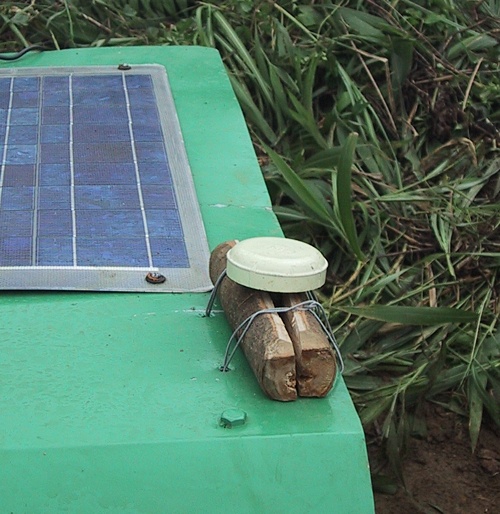
Once an hour the DAS turns on an internal Global Positioning System (GPS) receiver. Once the receiver is locked on to the satellites the DAS's internal clock is synchronized to the GPS time. Most seismology experiments are interested in determining the exact time that a seismic wave arrives at a recording station. If there is more than one recording station, the exact positions of the stations are known, and the exact time of the vibration's arrival at each station is recorded, then the location of the event that caused the vibration can be determined. For this experiment the DASs continuously listened for micro-earthquakes (MEQs) caused by the fracturing of the rock while injecting the water back into the geothermal field. Each of the three channel's signals from the sensor in the ground was looked at and recorded by the DAS 200 times per second. The data was "time stamped" with the accurate time so that the arrival time of any recorded waves could be determined. In order to get a GPS signal an antenna (below) was mounted on top of the dog houses sometimes using a split piece of kahoy (wood) as a base, bailing wire, and bailing wire. Duct tape wouldn't stick.
Also mounted on top was one 30-watt solar panel to charge the car battery in the doghouse, though there wasn't a lot of sunlight while I was there.
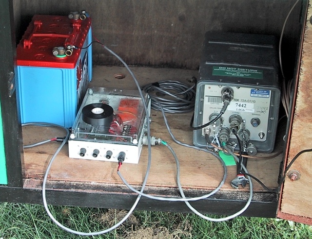
Inside the doghouse was one battery, a power regulator to control batter charging from the solar panel, and a DAS.
We were generally pretty entertaining everywhere we went. Apparently.

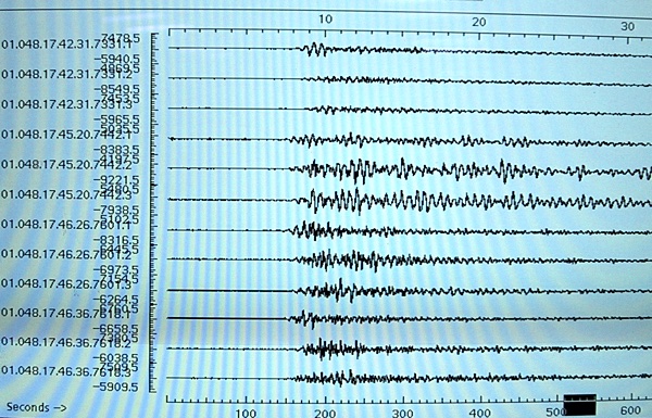
While the idea of this experiment was to measure micro-earthquakes just in the area around Tiwi, the equipment we installed was also used to record not so micro earthquakes in other places, which is just what happened. The photograph below shows an earthquake that was recorded by the first four stations that we installed early in the deployment phase. By checking a U.S. Geological Survey website we determined that this was a magnitude 5.5 earthquake located beneath the Philippine Sea about 600 kilometers north of Tiwi. It's always nice to know that your equipment actually IS working.
2018-02-08