


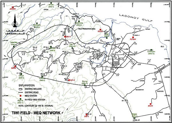
The map above covers an area of about 5,400 hectares. The area inside the irregular circle is the geothermal field. The red dots are the locations where we installed the Detailed MEQ Stations (DMS). It was about 7.5 kilometers between the two furthest stations.
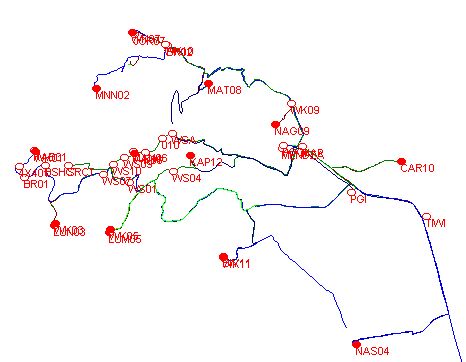
The graphic below shows the locations of the stations as recorded by my Garmin GPS, and some of the routes that we took to visit each of the sites -- both driving and walking. The dot "MNN02" on the map is the station at Manitonito, which will be explained on the next page.
2018-02-08